Overview | About the Project
About the Tropical Cyclone Guidance Project (TCGP)
This section provides background on the TCGP. The current page lays out an essay giving the history of TC forecast aids, their distribution, and the rationale for starting the TCGP. Other pages in this section provide a history of project updates, detail future plans, give the important disclaimer, guidelines for media, information on how to contact us, and acknowledgments.
What is tropical cyclone guidance?
For more than three decades, Tropical Cyclone Warning Centers (TCWCs) around the world have been using numerical guidance to assist them in their efforts to forecast the future track of tropical cyclones. Initially, these forecast aids were simple dynamical or statistical models that projected the future track of a storm. The 1990's witnessed a blossoming of many new Numerical Weather Prediction (NWP) models, including global models and regional (limited-area) models. During this period, a new statistical-dynamical method of predicting TC intensity also came onto the scene. As models became more complex, these models began including more and more of the physical processes important to the dynamics of TCs. By 2000, several forecast aids had been developed not only for predicting track, but also for predicting a storm's future intensity. As more knowledge and improved modeling techniques were incorporated into the forecast models, the track errors of the official forecasts declined steadily. Intensity errors declined at a much slower case, however.
In the past decade, models have become very sophisticated, with higher resolution, more complete physics packages, and complex schemes to assimilate the ever-growing amount of data so as to represent the storm as accurately as possible in the model's initial condition. Ensemble forecast techniques have also become widespread. These techniques seek to simulate the uncertainties present within the dynamical system that includes the storm and its environment. Such ensembles of model scenarios can give help forecasters estimate the range of possible outcomes, while the average across the various ensemble members can sometimes produce a forecast that is better than just one deterministic realization. The current suite of TC guidance now includes forecast aids which span the range of sophistication, from enormously complex global modeling systems, to highly refined regional models, to simpler statistical-dynamical aids that incorporate information from the global model forecasts to predict intensity or structure, and finally all the way back to some of the original, simple statistical forecast aids.
Distribution of the TC guidance
Traditionally, the forecast aids were not publicly available in any of the global basins in which TCs occur. The argument given for restricting dissemination of the forecast aids was that the general public would misinterpret the model projections, quite possibly leading them to ignore official warnings. Over the years, it has become evident that the public disregard official warnings for a wide variety of societal and sociological factors. In 2001, a Freedom of Information Act (FOIA) was filed requesting that the U.S. National Hurricane Center (NHC) make their forecast aids available to the general public. NHC complied and began distributing the files containing the track an intensity forecasts (these files are called "a-decks" because their filenames begin with the letter 'a' in the Automated Tropical Cyclone Forecast (ATCF) system). Within a few years, several web sites were disseminating plots of these forecast aids for the North Atlantic and the Northeast Pacific. People in these basins gradually became acquainted with the idea of forecast models and eventually plots of model forecasts started being shown on major television broadcasts during high profile hurricane landfalls.
In the other TC basins, forecast guidance is not normally made available to the public. Because global and regional modeling is such a resource-intensive enterprise, operational NWP centers tend to be organized at the national and supra-national scale (e.g., U.S. National Centers for Environmental Prediction (NCEP) and the European Centre for Medium-range Weather Forecasting (ECMWF). Additionally, the World Meteorological Organization (WMO) has designated Regional Specialized Meteorology Centers (RSMC) for the various ocean basins. These RMSCs are tasked with the responsibility of overseeing warning responsibilities in their respective basins. Since many smaller countries (especially in the Asia-Pacific and South Pacific regions), have only limited resources to run their own global and regional TC models, the RSMCs often share forecast aids with the various national or local Tropical Cyclone Warning Centers (TCWC) in their area of responsibility.
Because operational NWP forecasts may also have commercial value, certain NWP centers have not been willing to publicly share their operational forecasts in real-time. This tends to hinder the development of regionally-focused operational tropical cyclone forecast aids. The U.S. Navy's Joint Typhoon Warning Center (JTWC) does maintain a global repository of such forecast aids, but due to sensitive data-sharing agreements with these NWP centers, as well as national security concerns, these data are not available to the public in real-time (although the forecast aids are sometimes shared with regional warning centers on a case-by-case basis).
The need for broader dissemination of forecast aids
The World Meteorological Organization (WMO) has recognized that a wider effort is needed to promote the sharing and dissemination of tropical cyclone-related NWP products. In 2006, leading tropical cyclone experts at the WMO-sponsored International Workshop on Tropical Cyclones (IWTC-VI) designated the following as a high priority item in their major recommendations:
The WMO should take all necessary action to: 1) improve the communication between operational centres and facilitate the dissemination of all tropical cyclone-related NWP products, such as the deterministic and ensemble forecasts (including the full set of ensemble runs); and 2) make them available to all Regional Specialized Meteorological Centers (RSMC), Tropical Cyclone Warning Centers TCWC), and researchers in real-time.
WMO should investigate the most appropriate ways to achieve this goal:
coordinate with the NWP and major operational centres (RSMCs and TCWCs) in order to define a set of resolvable tropical cyclone characteristics to be provided and timely disseminated by the NWP centres through the GTS (e.g. centre location, minimum sea level pressure, max wind, wind radii by quadrants, etc…) and define the appropriate standardised format.
and/or find a WMO-sponsored dedicated reference centre (similarly to what has been done with the Severe Weather Information Centre for the dissemination of the analysis and forecast products issued by the main operational centres) able to host and maintain a single global data base of the tropical cyclone forecasts originating from the different NWP centres.
Since October 2006, the THORPEX Interactive Grand Global Ensemble (TIGGE) has archived ensemble forecasts from ten global NWP centers. These data are available to some researchers in near-real-time, although some data are delayed and/or secured behind password-protected web sites. Additionally, the NOAA Hurricane Forecast Improvement Project (HFIP) currently supports researchers in both academia and operational centers by collecting and disseminating forecast aids for the Atlantic Basin, although there are similar delays and restrictions on data access.
The advent of the Information Age, and the now ubiquitous World Wide Web, has fundamentally transformed the expectations of free societies and commerce. Social media sites like Facebook and Twitter have connected people together in many new ways and heightened the immediacy of real-time information. Other web sites like Wiki Leaks have attempted to force governments to be more transparent. Blogs have proliferated and media have become much more specialized, catering to users of various political persuasions. These changes, and others, have fractured the once monolithic media landscape so that now most people get their news and information from a wide variety of sources. These new information technologies have also revolutionized the methods in which science is done, enabling collaborations across continents and very large scale efforts to improve hurricane forecasts. On the one hand, the changes of the past couple decades raise new challenges to TC forecasters in their efforts to effectively warn the public. Yet, these changes also bring new opportunities. In particular, there is now an opportunity to engage a wider community of both researchers and operational forecasters in the development of new TC forecast aids. TCGP aims to foster this increased participation and to share these more effectively amongst the various warning centers and other stakeholders.
The need to go beyond just track and intensity
The forecast community has long focused on track and intensity because these are key attributes of the forecast (where will the storm be located, how intense will the maximum winds be). However, there is a pressing societal need to provide location-based information about storm hazards. More focus needs to be placed on developing probabilistic hazard models for wind, rainfall, flooding, and storm surge, as well as decision supports tools that help the public and other decision makers use this information to its fullest potential.
Given that the vast majority of tropical cyclone deaths are caused not by wind, but by aspects of the storm related to size, such as storm surge and inland flooding from rainfall, more focus needs to be placed on the prediction of storm structure (i.e., the changing configuration of the wind field and the distribution of convection). The development of forecast aids for basic parameters such as the radius of maximum winds (RMW) could certainly be a starting point. Also, the incorporation of a storm's past and present structure parameters in the development of new forecast aids should yield dividends for intensity prediction skill.
TCGP Inception
To make further progress towards the goals of increasing forecast aid development, especially in regions that currently lack access to reliable real-time guidance, and to provide impetus for the incorporation of structure information in forecast aid development, Dr. Jonathan Vigh [at the time a Postdoctoral Fellow in NCAR's Advanced Study Program (ASP), now a Project Scientist I in NCAR's Research Applications Laboratory], initiated the TCGP to provide an open web platform for the collection and dissemination of real-time tropical cyclone guidance forecast aids and structure data. Recognizing that a completely open, real-time platform will serve a more diverse user base, he hopes that this site can serve as a prototype for an eventual WMO-sponsored global repository of tropical cyclone forecast aids.
Relationship of the TCGP to the Joint Numerical Testbed (JNT)
While the TCGP can be considered as an independent, stand-alone project, it has been placed in RAL's organizational structure under JNT's Tropical Cyclone Modeling Team (TCMT). TCMT's other projects are geared towards demonstration and testing as a key component of NOAA's Hurricane Forecast Improvement Project (HFIP).
How is TCGP different from TCMT's HFIP-related projects?
The TCMT's HFIP projects have a well-defined mission to test and evaluate the current operational and experimental models for storms occurring in the basins for which NOAA has warning responsibility (the North Atlantic, North Eastern Pacific, and North Central Pacific). The various HFIP modeling groups upload their numerical weather prediction (NWP) model products for later verification and analysis. These products include both the track and intensity information (tier 1 data) obtained from trackers following the moving storm center, as well as the full 3-dimensional model fields (tier 2 data). Due to the experimental nature of some of these models, some data arrive late. Some of the modeling teams that contribute model data to TCMT have opted-in to sharing these data with TCGP as well, so TCMT serves as a valuable conduit for getting these data to TCGP.
In contrast, TCGP's main foci are to facilitate the rapid real-time sharing and visual dissemination of just the track and intensity information (tier 1 data), and to provide a platform for the distribution of additional structure and intensity parameters derived from reconnaissance aircraft. TCGP's open repository is separate and distinct from HFIP's repository, and will include just the ATCF-formatted a-deck files (tier 1 data), but for all global basins. Participation in TCGP's global repository is not limited in any way. Contributions are welcomed from any numerical modeling group, academic and government researchers, and commercial entities. If your modeling team would like to contribute your real-time model predictions to TCGP, please visit the TCGP section for model contributors.
Who are the TCGP stakeholders?
TCGP's primary stakeholders include real-time operational users such as the Regional Specialized Meteorological Centers (RSMC) and Tropical Cyclone Warning Centers (TCWC), National Hydro Meteorological Services (NHMS), academic and government research groups involved in developing new tropical cyclone forecast aids, and commercial entities with an interest in tropical cyclone prediction. Secondary stakeholders include experts from within the tropical meteorology community, emergency managers in hurricane-prone areas, commercial interests engaged in energy and risk trading, other agencies and companies tasked with the protection of resources, and last but certainly not least, the general public.
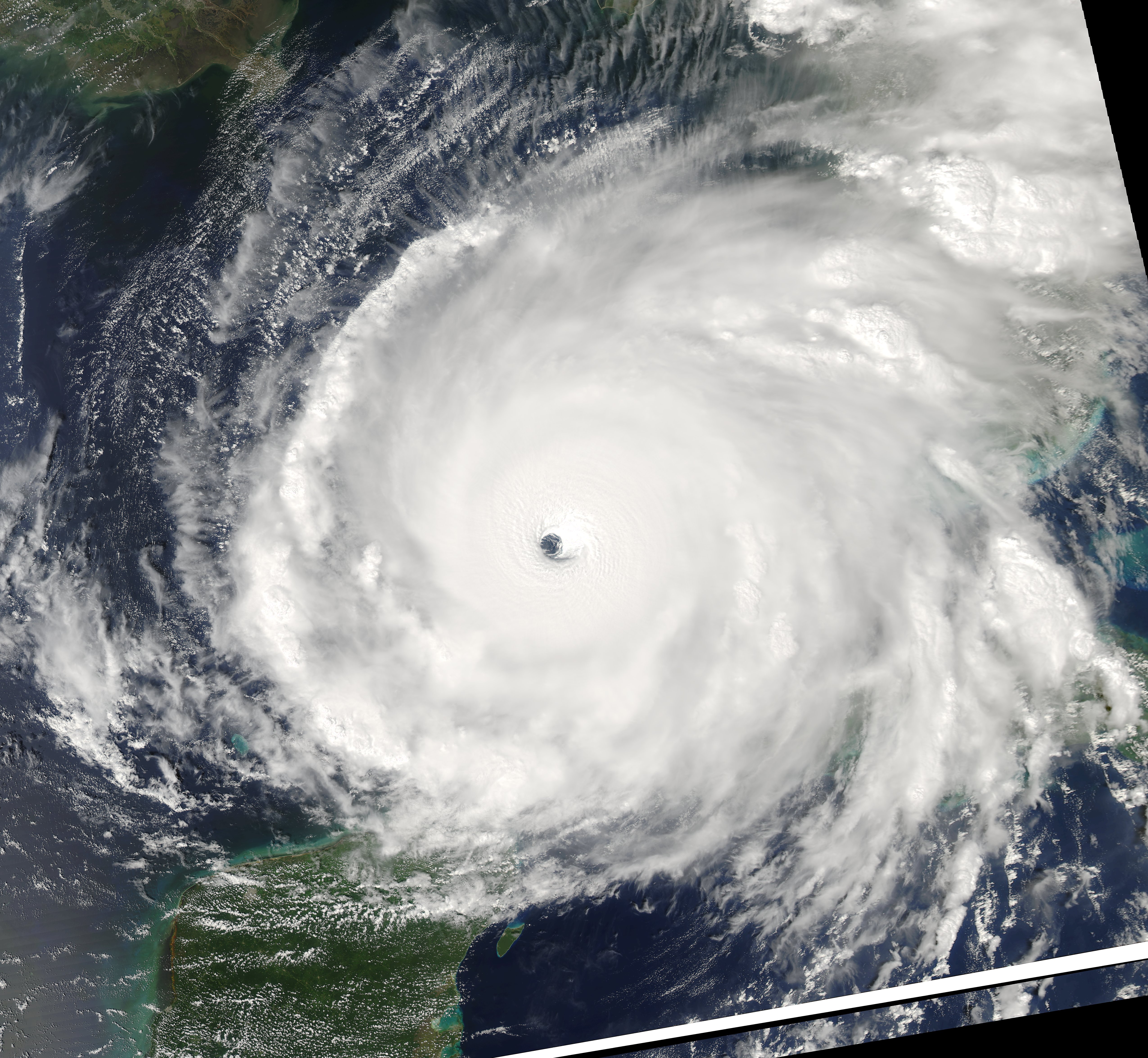
Hurricane Rita
The banner image of this site features a NASA satellite image of Hurricane Rita, taken at 1920 UTC on 21 Sep 2005. Click on the image to see the original high resolution image.